"It's in a flood zone" is one of the least useful sentences in Grand Strand real estate. Every property is in a flood zone — the question is which one, and the answer changes whether your lender can legally close your loan without a flood policy, what a surveyor needs to certify, and what you can do to the house after you own it.
The City of Myrtle Beach puts it about as directly as a municipality can: "If you live in the City of Myrtle Beach, your property is in or near the flood hazard area as mapped by the Federal Emergency Management Agency." That's not a reason to walk away — it's a reason to read the map before you write an offer. My complete guide to buying a home in Myrtle Beach covers where this fits in the overall cost picture; this is the zone-by-zone deep dive.
What a Flood Zone Actually Is
Federal regulation does the defining here, and the definitions are more precise than the way people talk about them.
Under 44 CFR § 59.1, the base flood is "the flood having a one percent chance of being equalled or exceeded in any given year" — a probability per year, not a promise that it happens once a century. An area of special flood hazard is "the land in the flood plain within a community subject to a 1 percent or greater chance of flooding in any given year," and the same regulation states that "special flood hazard area" (SFHA) means the same thing. A coastal high hazard area is "an area of special flood hazard extending from offshore to the inland limit of a primary frontal dune along an open coast and any other area subject to high velocity wave action from storms or seismic sources." That last one is why the beachfront gets its own letter.
The Zone Letters, Decoded
44 CFR § 64.3 sets out the symbols FEMA uses on a Flood Insurance Rate Map (FIRM). These are the ones you'll actually encounter on the Grand Strand:
| Zone | What § 64.3 says it means | In plain terms |
|---|---|---|
| A | Area of special flood hazard without water surface elevations determined | High-risk, but FEMA hasn't published a base flood elevation for it |
| AE | Area of special flood hazard with water surface elevations determined | High-risk with a published base flood elevation — the most common SFHA zone here |
| AO | Special flood hazards with shallow water depths and/or unpredictable flow paths between 1 and 3 ft | Sheet-flow / ponding areas |
| AH | Shallow water depths and/or unpredictable flow paths between 1 and 3 feet, with water surface elevations determined | Shallow flooding with a published elevation |
| A99 | Special flood hazard where enough progress has been made on a protective system to consider it complete for insurance rating purposes | Protected by a system still being finished |
| V | Special flood hazards without water surface elevations determined, with velocity, inundated by tidal floods (coastal high hazard area) | Wave-action coastal zone, no published elevation |
| VE | Special flood hazards, with water surface elevations determined and with velocity, inundated by tidal floods (coastal high hazard area) | The oceanfront wave-action zone, with a published elevation |
| B, X | Areas of moderate flood hazards | The "shaded X" you'll hear about — outside the SFHA |
| C, X | Area of minimal hazards | Standard X — outside the SFHA |
| D | Area of undetermined but possible, flood hazards | Risk hasn't been analyzed |
The practical split is simple: A-something and V-something are inside the Special Flood Hazard Area. X and D are not. VE differs from AE because of velocity — wave action, not just standing water — and that drives stricter construction requirements on the buildings inside it.
Why the Zone Decides What Your Lender Can Do
This is the part buyers underestimate. Flood coverage in an SFHA isn't a recommendation; for most loans it's federal law.
Under 42 U.S.C. § 4012a(b), regulated lending institutions are directed not to make, increase, extend, or renew any loan secured by improved real estate located in an identified special flood hazard area where NFIP coverage is available, unless the building is covered for the term of the loan for at least the outstanding principal balance or the maximum coverage available, whichever is less. Federal agency lenders are under the same restriction.
Section 64.3(b) lists exactly which zones trigger it: "The mandatory purchase of insurance is required within designated Zones A, A1-30, AE, A99, AO, AH, AR, AR/A1-30, AR/AE, AR/AO, AR/AH, AR/A, V1-30, VE, V, VO, M, and E."
Two things follow that are worth knowing before you shop lenders:
- Zone X carries no federal mandate. Your lender can still require coverage as a matter of its own policy. And note what § 64.3 actually calls the X zones — "areas of moderate flood hazards" and "area of minimal hazards," not zero. Any walled and roofed building in a participating community is eligible to buy a policy, in or out of a floodplain.
- Your lender must accept qualifying private flood insurance. Section 4012a(b)(1)(B) requires regulated lenders to accept private flood insurance as satisfaction of the requirement when the coverage meets the statutory standard. If the first NFIP quote you get is painful, that's not the end of the conversation.
Statutory NFIP limits, for scale: under 42 U.S.C. § 4013, coverage for a residential building designed for occupancy of one to four families is made available up to an aggregate of $250,000, with residential contents coverage up to $100,000. Contents must be purchased separately from building coverage. Anything above those limits is excess coverage from another market.
How to Look Up a Specific Address Here
Zones change block to block, and sometimes lot to lot. Never rely on a neighborhood-level impression. On the Grand Strand you have four real options:
- Horry County's FEMA flood maps. The county has scanned and converted the FIRMs for Horry County for online viewing, and publishes its own flood maps and a "Map Your Move" tool through its FEMA Flood Maps page.
- The City of Myrtle Beach's floodplain maps. The city publishes a map of the 100-year and 500-year floodplains online, and holds a larger, lot-by-lot map showing flood zones and required elevations in Construction Services at the City Services Building on Oak Street.
- Certified Floodplain Managers at the city. Available in Construction Services to help with maps and retrofitting advice; current and past FEMA FIRMs and topographical maps showing property elevations are available for review, and FIRMs and reference materials are also kept at Chapin Memorial Library.
- The seller's own documents. Ask for the existing flood policy declarations page and any elevation certificate. What a South Carolina seller is actually obligated to tell you is narrower than most buyers assume — I cover it in South Carolina seller disclosure requirements.
Base Flood Elevation and the Elevation Certificate
A zone tells you the category. The base flood elevation (BFE) tells you the number — the height floodwater is expected to reach in a base flood. What matters for a specific house is how its lowest floor sits relative to that number.
That relationship is documented in an elevation certificate, prepared by a licensed surveyor or engineer. In Myrtle Beach, all development in the regulatory floodplain requires an elevation certificate before, during, and after construction — and here's the due-diligence tip most buyers never hear: copies of elevation certificates submitted in the past are available for review from the Construction Services Department during regular business hours. If the house you're considering was built or substantially improved in the floodplain, a certificate may already exist. Ask before you pay a surveyor for a new one.
The city also builds in freeboard, which § 59.1 defines as "a factor of safety usually expressed in feet above a flood level for purposes of flood plain management." Myrtle Beach requires that all new residential structures in the regulatory floodplain be elevated no less than three feet above the base flood elevation — a stricter standard than the federal minimum, and part of why the city's NFIP rating is what it is.
What Myrtle Beach Adds on Top of the Federal Rules
A few local requirements shape what you can buy, and what you can do with it afterward:
- Outside the special flood hazard area, city code still requires the minimum finished floor elevation for new construction to be at least 18 inches above the highest crown of any abutting street, or 24 inches above the average grade of the lot — and the lowest floor plus all mechanical and electrical equipment must meet it.
- The 50% rule. Buildings with damage amounting to 50 percent or more of the building's value must be removed or brought into full compliance with the floodplain regulations, and existing non-compliant buildings may only be improved to less than 50 percent of the building's value — a limit that applies to additions and alterations, not just storm repairs. Federal regulation uses the same threshold: § 59.1 defines substantial improvement as work costing 50 percent or more of the structure's pre-improvement market value, and substantial damage as damage where restoration would cost 50 percent or more of pre-damage market value.
- The Coastal Protection Zone. Article 18 of the city's zoning ordinance provides supplementary regulations for oceanfront property seaward of the projected 50-year erosion control line, aimed at controlling erosion, preserving the recreational beach, and safeguarding property.
- CRS participation. The city has participated in the NFIP's Community Rating System since 1991 and is rated a "Class 5," which means flood insurance premiums in Myrtle Beach are lower than they otherwise would be.
If you're renovating an older oceanfront property, the 50% rule is the single most important sentence above. A gut renovation of a non-compliant structure can trigger a requirement to bring the whole building into compliance — meaning elevation. Price that in before you fall in love with a fixer.
What Actually Floods Here
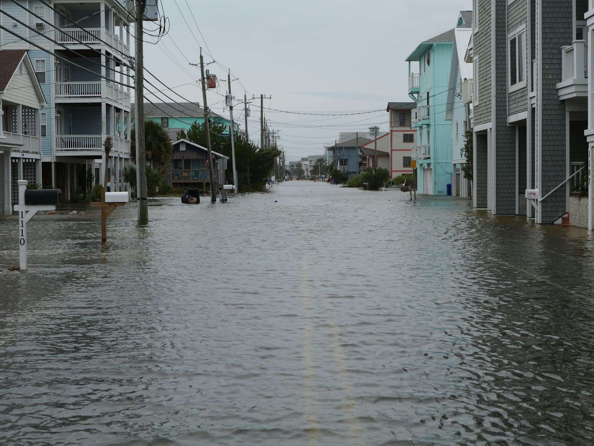
The city's own description of local flood mechanics beats any general coastal advice: most flooding in Myrtle Beach is caused by ocean water and rain driven landward by severe storms, with heavy rains occasionally causing localized flooding, and major flooding occurring along the beachfront and inland along the swashes.
Five main swash areas run through the city — Bear Branch, Cane Patch, Deep Head, Midway, and Withers. Low land near those swashes is prone to flooding, and it's often well back from the beach. Along the beachfront, storm-driven flood waters can rise to 15 to 20 feet above mean sea level with destructive waves reaching higher, and most of the land east of Ocean Boulevard / Beach Drive sits in that floodplain. That combination is why "how far from the water is it?" is a bad proxy for flood risk here.
If You Think the Map Is Wrong
Map lines come from topography, and topography at parcel scale isn't perfect. Federal regulation provides a correction procedure in 44 CFR Part 70, which exists precisely because of "the technical difficulty of accurately delineating the curvilinear line" on a FIRM. Under § 70.3, any owner or lessee who believes their property was inadvertently included in an A- or V-series zone may submit scientific or technical information to FEMA for review — typically:
- a recorded plat map bearing the seal of the appropriate recordation official;
- a topographical map showing ground elevation contours, the total area of the property, the location of the structures, the elevation of the lowest adjacent grade, and the curvilinear line representing the area subject to inundation by a base flood; and
- a certification by a Registered Professional Engineer or Licensed Land Surveyor that the lowest grade adjacent to the structure is above the base flood elevation.
Under § 70.4, FEMA must notify the applicant in writing of its determination within 60 days of receiving the information — either confirming the zone, agreeing the property should not be in it and modifying the map, or requesting an additional 60 days.
One important limit: Part 70 does not apply where there has been any alteration of topography since the effective date of the first NFIP map showing the property in a special flood hazard area. If someone brought in fill, that's a different process under Part 65.
Sixty days is longer than most due diligence periods on the Grand Strand. If a map correction is central to your decision, raise it in the offer, not after inspections.
Timing: The 30-Day Waiting Period and Its Exceptions
This one derails closings. Under 44 CFR § 61.11(d), a new NFIP policy generally becomes effective at 12:01 a.m. on the 30th calendar day after the application date and payment of premium.
Two exceptions matter to buyers:
- Loan closings. Where the initial purchase is in connection with the making, increasing, extension, or renewal of a loan, coverage is effective as of the time of the loan closing — provided the written request is received, the policy is applied for, and the premium is presented at or prior to closing. Your lender's flood policy does not sit in a 30-day queue.
- Recent map revisions. During the 13-month period beginning on the effective date of a revised FIRM or Flood Hazard Boundary Map for a community, initial coverage is effective at 12:01 a.m. on the first calendar day after application and payment.
If you're buying with cash, neither exception applies by default — so start the flood policy at least 30 days before you plan to close, not the week of. Either way, the policy is a closing-day item; it's on my closing checklist.
Frequently Asked Questions
Does a flood zone designation mean the house has flooded? No. A zone is a mapped probability for an area, not a claims history for a building. Ask separately about the property's actual flood history, and ask for the seller's flood policy declarations page.
Is Zone X safe? X means outside the special flood hazard area, and no federal mandatory purchase requirement attaches to it. It doesn't mean the property can't flood, and coverage is available to any walled and roofed building in a participating community.
What's the difference between AE and VE? Both are special flood hazard areas with published water surface elevations. VE adds velocity — it's the coastal high hazard area subject to wave action, which carries stricter construction standards.
Do condos work differently? The building's master policy usually carries the flood coverage, and what it covers varies by association. That's an association-documents question — I cover how to read those in my condo buying guide.
Is flood insurance the same thing as wind coverage? No, and conflating them is the most expensive mistake I see on the coast. They're separate policies with separate triggers, and on this coast wind can be carved out of a homeowners policy entirely. I explain when and where in wind insurance in coastal South Carolina.
Can I get an elevation certificate before I'm under contract? You can order a new one from a licensed surveyor at any time, and in Myrtle Beach you can also ask Construction Services whether a past certificate for the property is on file. That's usually the faster and cheaper first move.
Pull the Map Before You Write the Offer
I check the zone on every property I show, before we talk about anything else — it changes the insurance conversation, the lender conversation, and sometimes the renovation plan. It takes minutes, and it's the cheapest due diligence in the transaction.
If you're weighing specific addresses, browse current listings, read up on the communities along the Strand, or get in touch and I'll pull the flood map — and the property tax estimate — on anything you're considering. My client resources page has the local insurance agents and inspectors who deal with this every day.
This article explains how the rules work; it isn't insurance or legal advice. Verify a specific property's zone and requirements with the City of Myrtle Beach or Horry County directly, and get an actual quote from a licensed agent before your due diligence period expires.
Thinking about making the move to the Grand Strand?
Whether you're relocating from up north or planning your retirement on the South Carolina coast, I'd love to help you get there. Follow me on Facebook for more local tips, search Grand Strand listings right here on my site, and join one of my Facebook groups built specifically for people making this move: